Maps by Region & Period
40 historical maps across 5 periods
Ancient Period
Maps from antiquity — Ptolemy, Roman roads, and classical cartography — 4 maps
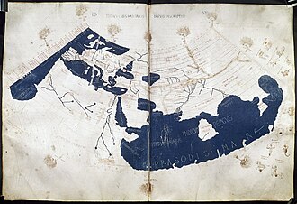
Ptolemy World Map
The Ptolemy world map is a map of the world known to Greco-Roman societies in the 2nd century. It is based on the descri
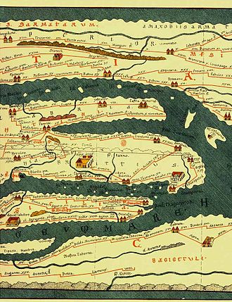
Tabula Peutingeriana
Tabula Peutingeriana, also known as Peutinger's Tabula, Peutinger tables and Peutinger Table, is an illustrated itinerar
Roman Empire at its Height (117 AD)
Map showing the Roman Empire at its greatest territorial extent under Emperor Trajan in 117 AD, stretching from Britain
Silk Road Trade Routes
Map of the ancient Silk Road trade network connecting China to the Mediterranean, including maritime routes through Sout
Medieval Period
Maps from the Middle Ages — Mappa Mundi, portolan charts, and Islamic cartography — 5 maps
Tabula Rogeriana (1154)
The Tabula Rogeriana was created by Arab geographer Muhammad al-Idrisi for King Roger II of Sicily in 1154. It took 15 y
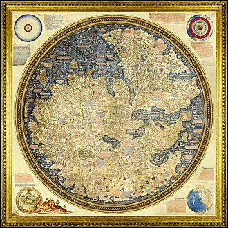
Fra Mauro Map
The Fra Mauro map is a map of the world made around 1450 by the Italian (Venetian) cartographer Fra Mauro, which is “con
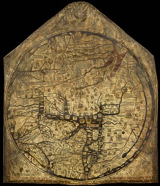
Hereford Mappa Mundi
The Hereford Mappa Mundi is the largest medieval map still known to exist, depicting the known world. It is a religious

Al-Idrisi World Map
The Nuzhat al-mushtāq fī ikhtirāq al-āfāq, commonly known in the West as the Tabula Rogeriana, is an atlas commissioned
Medieval Europe (1200)
Map of medieval Europe around 1200 CE showing the Holy Roman Empire, Kingdom of France, English territories, and the var
Renaissance
Age of Discovery — Waldseemüller, Mercator, and the New World — 8 maps
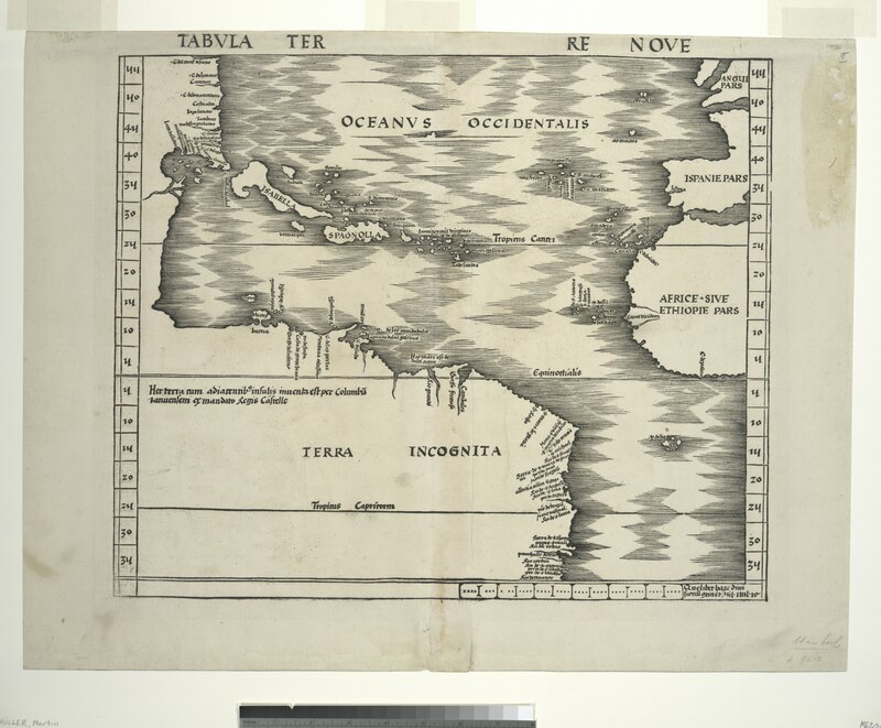
Waldseemüller Map (1507)
Martin Waldseemüller's 1507 world map is famous for being the first to use the name "America" to describe the New World,
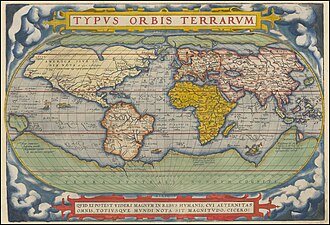
Mercator World Map (1569)
Gerardus Mercator's 1569 world map introduced the Mercator projection, a cylindrical conformal projection that became th
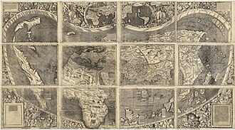
Waldseemüller Map (1507)
The Waldseemüller map or Universalis Cosmographia is a printed wall map of the world by the German cartographer Martin W
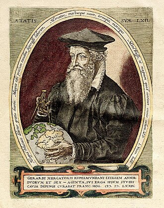
Mercator World Map (1569)
The Mercator world map of 1569 is titled Nova et Aucta Orbis Terrae Descriptio ad Usum Navigantium Emendate Accommodat
Ortelius Theatrum Orbis Terrarum
Theatrum Orbis Terrarum is considered to be the first true modern atlas. Written by Abraham Ortelius, strongly encourage

Cantino Planisphere
The Cantino planisphere or Cantino world map is a manuscript Portuguese world map preserved at the Biblioteca Estense in
Voyages of Columbus (1492-1504)
Map showing the four voyages of Christopher Columbus across the Atlantic to the Americas between 1492 and 1504.
Age of Exploration Routes (1400-1600)
Map showing the major maritime exploration routes of Portuguese, Spanish, Dutch, and English explorers during the Age of
Early Modern
16th–18th century — colonial maps, atlas production, and scientific cartography — 11 maps
Blaeu World Map (1664)
Joan Blaeu's world map from the Atlas Maior (1662-1664) represents the pinnacle of Dutch Golden Age cartography. The dou
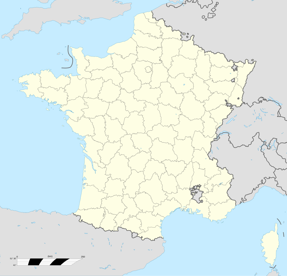
Cassini Map of France (1789)
The Carte de Cassini was the first topographic map of France and the first map of an entire country based on geodetic tr
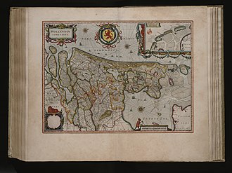
Blaeu Atlas Maior — World
The Atlas Maior is the final version of Joan Blaeu's atlas, published in Amsterdam between 1662 and 1672, in Latin, Fren
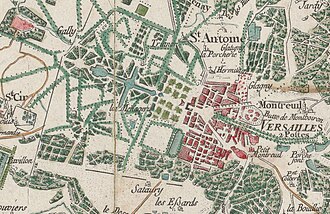
Cassini Map of France
The Cassini Map or Academy's Map is the first topographic and geometric map made of the Kingdom of France as a whole. It
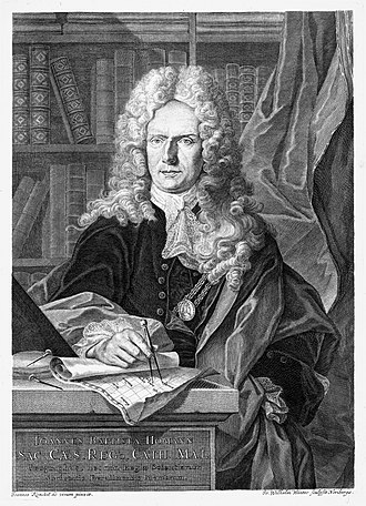
Homann Map of Africa
Johann Baptist Homann was a German geographer and cartographer, who also made maps of the Americas. From the Nuremberg
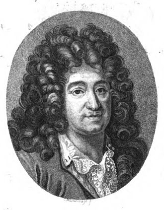
Jaillot Map of North America
Alexis-Hubert Jaillot was a geographer and French cartographer, publisher at Paris, from the late 17th century and begin

Coronelli Globe Gores — Asia
Vincenzo Maria Coronelli was an Italian Franciscan friar, cosmographer, cartographer, publisher, and encyclopedist known

Map of South America (1700)
Guillaume Delisle, also spelled Guillaume de l'Isle, or Guillelmo Delille was a French cartographer known for his popula
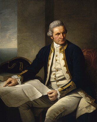
Cook's Chart of New Zealand
Captain James Cook was a British Royal Navy officer, explorer, and cartographer who led three voyages of exploration to
Ottoman Empire Map (1683)
Map of the Ottoman Empire at its greatest extent around the Siege of Vienna in 1683, spanning three continents.
Mughal Empire Map (1700)
Map of the Mughal Empire at its zenith under Aurangzeb, covering most of the Indian subcontinent.
Modern Era
19th–20th century — topographic surveys, world wars, and geopolitical maps — 12 maps
Map of the British Empire (1886)
Walter Crane's 1886 "Imperial Federation" map dramatically illustrated the extent of the British Empire, which at its he
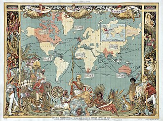
British Empire Map (1886)
The Imperial Federation was a series of proposals in the late 19th and early 20th centuries to create a federal union to

USGS Topographic Map
The United States Geological Survey (USGS), founded as the Geological Survey, is an agency of the United States Departme
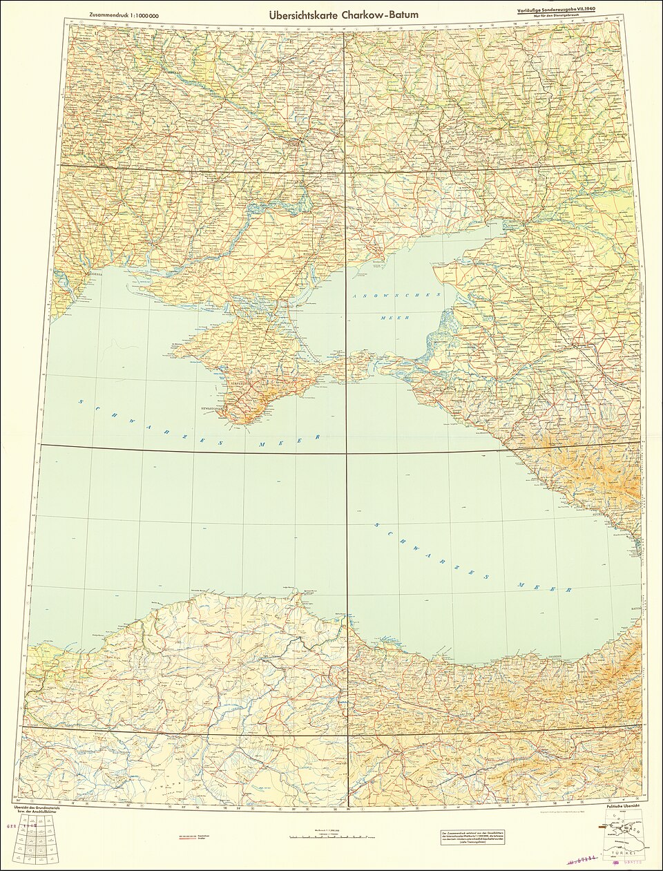
Soviet Military Map
The Soviet Union created the most comprehensive mapping of the entire world ever attempted, mapping foreign countries in
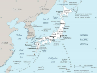
Japanese Map of Asia (1914)
The earliest known term used for maps in Japan is believed to be kata, which was probably in use until roughly the 8th c

Dymaxion Map (Fuller)
The Dymaxion map projection, also called the Fuller projection, is a kind of polyhedral map projection of the Earth's su
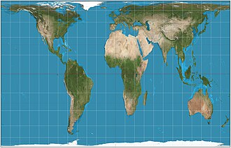
Peters Projection World Map
The Gall–Peters projection is a rectangular, equal-area map projection. Like all equal-area projections, it distorts mos
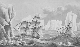
Map of Antarctica (1940s)
The history of Antarctica emerges from early Western theories of a vast continent, known as Terra Australis, believed to
Scramble for Africa (1885)
Map showing the European colonial partition of Africa following the Berlin Conference of 1884-85.
Louisiana Purchase Map (1803)
Map showing the Louisiana Purchase territory acquired by the United States from France in 1803, doubling the size of the
World War I Map (1914-1918)
Map showing the Allied and Central Powers during World War I, including major fronts and battle lines.
Cold War World Map (1947-1991)
Map showing NATO and Warsaw Pact alignments, non-aligned nations, and key Cold War flashpoints.
Our Partners
Trusted partner applications powering global data and insights