Maps by Region & Period
40 historical maps across 5 periods
All Periods
Ancient Period (4)
Medieval Period (5)
Renaissance (8)
Early Modern (11)
Modern Era (12)
Ancient Period
Maps from antiquity — Ptolemy, Roman roads, and classical cartography — 4 maps
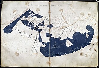
Ptolemy's World Map (c. 150 CE)
Claudius Ptolemy's Geographia, written around 150 CE in Alexandria, contained instructions for mapping the known world u
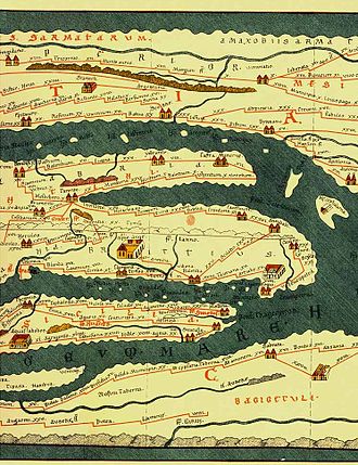
Tabula Peutingeriana
Tabula Peutingeriana, also known as Peutinger's Tabula, Peutinger tables and Peutinger Table, is an illustrated itinerar
Roman Empire at its Height (117 AD)
Map showing the Roman Empire at its greatest territorial extent under Emperor Trajan in 117 AD, stretching from Britain
Silk Road Trade Routes
Map of the ancient Silk Road trade network connecting China to the Mediterranean, including maritime routes through Sout
Our Partners
Trusted partner applications powering global data and insights