Maps by Region & Period
40 historical maps across 5 periods
Renaissance
Age of Discovery — Waldseemüller, Mercator, and the New World — 8 maps
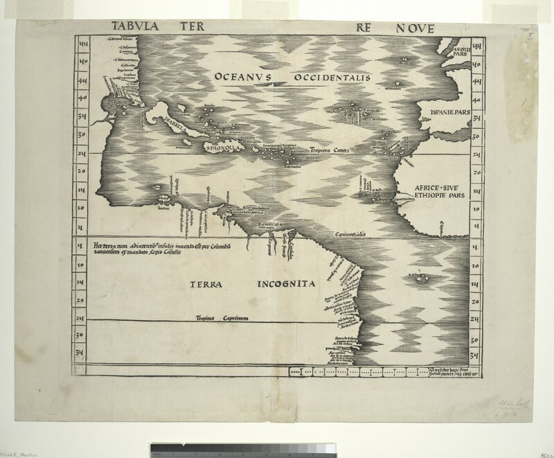
Waldseemüller Map (1507)
Martin Waldseemüller's 1507 world map is famous for being the first to use the name "America" to describe the New World,
Mercator World Map (1569)
Gerardus Mercator's 1569 world map introduced the Mercator projection, a cylindrical conformal projection that became th
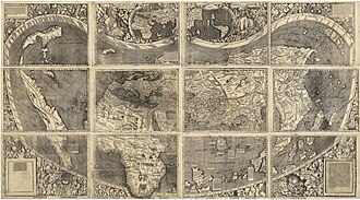
Waldseemüller Map (1507)
The Waldseemüller map or Universalis Cosmographia is a printed wall map of the world by the German cartographer Martin W
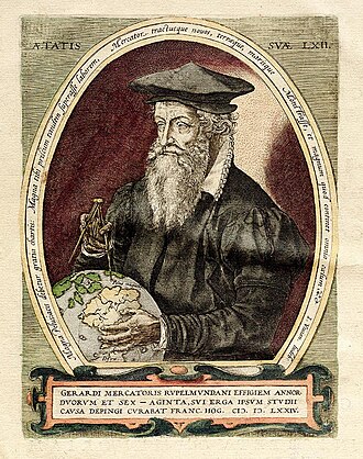
Mercator World Map (1569)
The Mercator world map of 1569 is titled Nova et Aucta Orbis Terrae Descriptio ad Usum Navigantium Emendate Accommodat
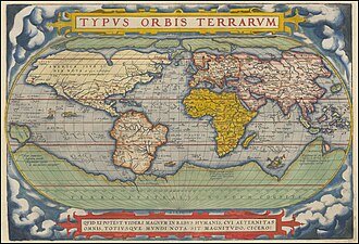
Ortelius Theatrum Orbis Terrarum
Theatrum Orbis Terrarum is considered to be the first true modern atlas. Written by Abraham Ortelius, strongly encourage

Cantino Planisphere
The Cantino planisphere or Cantino world map is a manuscript Portuguese world map preserved at the Biblioteca Estense in
Voyages of Columbus (1492-1504)
Map showing the four voyages of Christopher Columbus across the Atlantic to the Americas between 1492 and 1504.
Age of Exploration Routes (1400-1600)
Map showing the major maritime exploration routes of Portuguese, Spanish, Dutch, and English explorers during the Age of
Our Partners
Trusted partner applications powering global data and insights