Maps by Region & Period
40 historical maps across 5 periods
Medieval Period
Maps from the Middle Ages — Mappa Mundi, portolan charts, and Islamic cartography — 5 maps
Tabula Rogeriana (1154)
The Tabula Rogeriana was created by Arab geographer Muhammad al-Idrisi for King Roger II of Sicily in 1154. It took 15 y
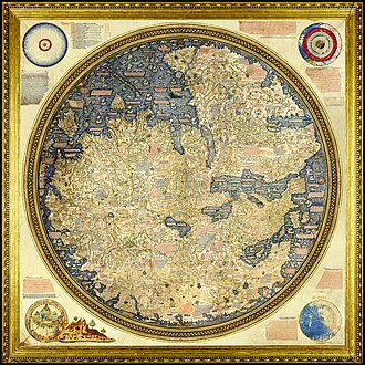
Fra Mauro Map
The Fra Mauro map is a map of the world made around 1450 by the Italian (Venetian) cartographer Fra Mauro, which is “con
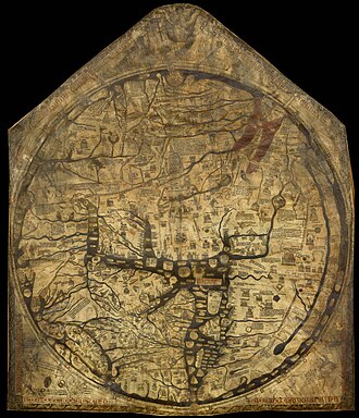
Hereford Mappa Mundi
The Hereford Mappa Mundi is the largest medieval map still known to exist, depicting the known world. It is a religious

Al-Idrisi World Map
The Nuzhat al-mushtāq fī ikhtirāq al-āfāq, commonly known in the West as the Tabula Rogeriana, is an atlas commissioned
Medieval Europe (1200)
Map of medieval Europe around 1200 CE showing the Holy Roman Empire, Kingdom of France, English territories, and the var
Our Partners
Trusted partner applications powering global data and insights