2023 Edition
CIA World Factbook 2023 (factbook.json @ 0d4fa4984ecb)
Introduction
Background
The Berber and Bafour people were among the first to settle in what is now Mauritania. Originally a nomadic people, they were among the first in recorded history to convert from a nomadic to agricultural lifestyle. These groups account for roughly one third of Mauritania’s ethnic makeup. The remainder of Mauritania’s ethnic groups derive from former enslaved peoples and Sub-Saharan ethnic groups originating mainly from the Senegal River Valley. These three groups are organized according to a strict caste system with deep ethnic divides that still exist today.A former French colony, Mauritania achieved independence from France in 1960. Mauritania initially began as a single-party, authoritarian regime and saw 49 years of dictatorships, flawed elections, failed attempts at democracy, and military coups. Ould Abdel AZIZ led the last coup in 2008, and was elected president in 2009 and reelected in 2014. Mohamed Ould Cheikh GHAZOUANI was elected president in 2019, and his inauguration marked the first peaceful transition of power from one democratically elected president to another, solidifying Mauritania’s status as an emerging democracy. International observers recognized the elections as relatively free and fair. The country is working to address a continuing practice of slavery and its vestiges. Mauritania officially abolished slavery in 1981, but the practice was not criminalized until 2007. Between 2005 and 2011, Al-Qaeda in the Islamic Maghreb (AQIM) launched a series of attacks killing American and foreign tourists and aid workers, attacking diplomatic and government facilities, and ambushing Mauritanian soldiers and gendarmes. Although Mauritania has not seen an attack since 2011, AQIM and similar groups remain active in the Sahel region.
Geography
Area
- land
- 1,030,700 sq km
- total
- 1,030,700 sq km
- water
- 0 sq km
Area - comparative
slightly larger than three times the size of New Mexico; about six times the size of Florida
Climate
desert; constantly hot, dry, dusty
Coastline
754 km
Elevation
- highest point
- Kediet Ijill 915 m
- lowest point
- Sebkhet Te-n-Dghamcha -5 m
- mean elevation
- 276 m
Geographic coordinates
20 00 N, 12 00 W
Geography - note
Mauritania is considered both a part of North Africa's Maghreb region and West Africa's Sahel region; most of the population is concentrated in the cities of Nouakchott and Nouadhibou and along the Senegal River in the southern part of the country
Irrigated land
450 sq km (2012)
Land boundaries
- border countries
- Algeria 460 km; Mali 2,236 km; Morocco 1,564 km; Senegal 742 km
- total
- 5,002 km
Land use
- agricultural land
- 38.5% (2018 est.)
- agricultural land: arable land
- arable land: 0.4% (2018 est.)
- agricultural land: permanent crops
- permanent crops: 0% (2018 est.)
- agricultural land: permanent pasture
- permanent pasture: 38.1% (2018 est.)
- forest
- 0.2% (2018 est.)
- other
- 61.3% (2018 est.)
Location
Western Africa, bordering the North Atlantic Ocean, between Senegal and Western Sahara
Major aquifers
Senegalo-Mauritanian Basin, Taodeni-Tanzerouft Basin
Major rivers (by length in km)
Senegal river mouth (shared with Guinea [s], Senegal and Mali) - 1,641 kmnote – [s] after country name indicates river source; [m] after country name indicates river mouth
Major watersheds (area sq km)
Atlantic Ocean drainage: Niger (2,261,741 sq km), Senegal (456,397 sq km)
Map references
Africa
Maritime claims
- contiguous zone
- 24 nm
- continental shelf
- 200 nm or to the edge of the continental margin
- exclusive economic zone
- 200 nm
- territorial sea
- 12 nm
Natural hazards
hot, dry, dust/sand-laden sirocco wind primarily in March and April; periodic droughts
Natural resources
iron ore, gypsum, copper, phosphate, diamonds, gold, oil, fish
Population distribution
with most of the country being a desert, vast areas of the country, particularly in the central, northern, and eastern areas, are without sizeable population clusters; half the population lives in or around the coastal capital of Nouakchott; smaller clusters are found near the southern border with Mali and Senegal as shown in this population distribution map
Terrain
mostly barren, flat plains of the Sahara; some central hills
People and Society
Age structure
- 0-14 years
- 36.11% (male 769,229/female 763,465)
- 15-64 years
- 59.58% (male 1,197,311/female 1,331,815)
- 65 years and over
- 4.31% (2023 est.) (male 77,123/female 105,935)
Alcohol consumption per capita
- beer
- 0 liters of pure alcohol (2019 est.)
- other alcohols
- 0 liters of pure alcohol (2019 est.)
- spirits
- 0 liters of pure alcohol (2019 est.)
- total
- 0 liters of pure alcohol (2019 est.)
- wine
- 0 liters of pure alcohol (2019 est.)
Birth rate
27.6 births/1,000 population (2023 est.)
Child marriage
- men married by age 18
- 1.2% (2021 est.)
- women married by age 15
- 15.5%
- women married by age 18
- 36.6%
Children under the age of 5 years underweight
22.4% (2022)
Contraceptive prevalence rate
11.5% (2019/20)
Current health expenditure
3.4% of GDP (2020)
Currently married women (ages 15-49)
66% (2023 est.)
Death rate
7.3 deaths/1,000 population (2023 est.)
Demographic profile
With a sustained total fertility rate of about 3.5 children per woman and almost 60% of the population under the age of 25 as of 2020, Mauritania's population is likely to continue growing for the foreseeable future. Mauritania's large youth cohort is vital to its development prospects, but available schooling does not adequately prepare students for the workplace. Girls continue to be underrepresented in the classroom, educational quality remains poor, and the dropout rate is high. The literacy rate is only about 50%, even though access to primary education has improved since the mid-2000s. Women's restricted access to education and discriminatory laws maintain gender inequality - worsened by early and forced marriages and female genital cutting. The denial of education to black Moors also helps to perpetuate slavery. Although Mauritania abolished slavery in 1981 (the last country in the world to do so) and made it a criminal offense in 2007, the millenniums-old practice persists largely because anti-slavery laws are rarely enforced and the custom is so ingrained. According to a 2018 nongovernmental organization's report, a little more than 2% of Mauritania's population is enslaved, which includes individuals subjected to forced labor and forced marriage, while many thousands of individuals who are legally free contend with discrimination, poor education, and a lack of identity papers and, therefore, live in de facto slavery. The UN and international press outlets have claimed that up to 20% of Mauritania's population is enslaved, which would be the highest rate worldwide. Drought, poverty, and unemployment have driven outmigration from Mauritania since the 1970s. Early flows were directed toward other West African countries, including Senegal, Mali, Cote d'Ivoire, and Gambia. The 1989 Mauritania-Senegal conflict forced thousands of black Mauritanians to take refuge in Senegal and pushed labor migrants toward the Gulf, Libya, and Europe in the late 1980s and early 1990s. Mauritania has accepted migrants from neighboring countries to fill labor shortages since its independence in 1960 and more recently has received refugees escaping civil wars, including tens of thousands of Tuaregs who fled Mali in 2012. Mauritania was an important transit point for Sub-Saharan migrants moving illegally to North Africa and Europe. In the mid-2000s, as border patrols increased in the Strait of Gibraltar, security increased around Spain's North African enclaves (Ceuta and Melilla), and Moroccan border controls intensified, illegal migration flows shifted from the Western Mediterranean to Spain's Canary Islands. In 2006, departure points moved southward along the West African coast from Morocco and then Western Sahara to Mauritania's two key ports (Nouadhibou and the capital Nouakchott), and illegal migration to the Canaries peaked at almost 32,000. The numbers fell dramatically in the following years because of joint patrolling off the West African coast by Frontex (the EU's border protection agency), Spain, Mauritania, and Senegal; the expansion of Spain's border surveillance system; and the 2008 European economic downturn.
Dependency ratios
- elderly dependency ratio
- 6
- potential support ratio
- 16.8 (2021 est.)
- total dependency ratio
- 82.7
- youth dependency ratio
- 76.8
Drinking water source
- improved: rural
- rural: 68.4% of population
- improved: total
- total: 85.2% of population
- improved: urban
- urban: 98.7% of population
- unimproved: rural
- rural: 31.6% of population
- unimproved: total
- total: 14.8% of population (2020 est.)
- unimproved: urban
- urban: 1.3% of population
Education expenditures
1.9% of GDP (2020 est.)
Ethnic groups
Black Moors (Haratines - Arabic-speaking descendants of African origin who are or were enslaved by White Moors) 40%, White Moors (of Arab-Berber descent, known as Beydane) 30%, Sub-Saharan Mauritanians (non-Arabic speaking, largely resident in or originating from the Senegal River Valley, including Halpulaar, Fulani, Soninke, Wolof, and Bambara ethnic groups) 30%
Gross reproduction rate
1.71 (2023 est.)
Infant mortality rate
- female
- 43.9 deaths/1,000 live births
- male
- 55.8 deaths/1,000 live births
- total
- 50 deaths/1,000 live births (2023 est.)
Languages
- Languages
- Arabic (official and national), Pular, Soninke, Wolof (all national languages), French; note - the spoken Arabic in Mauritania differs considerably from the Modern Standard Arabic used for official written purposes or in the media; the Mauritanian dialect, which incorporates many Berber words, is referred to as Hassaniya
- major-language sample(s)
- كتاب حقائق العالم، المصدر الذي لا يمكن الاستغناء عنه للمعلومات الأساسية (Arabic)The World Factbook, the indispensable source for basic information.
Life expectancy at birth
- female
- 68.1 years
- male
- 63.1 years
- total population
- 65.6 years (2023 est.)
Literacy
- definition
- age 15 and over can read and write
- female
- 62.2% (2021)
- male
- 71.8%
- total population
- 67%
Major infectious diseases
- animal contact diseases
- rabies
- degree of risk
- very high (2023)
- food or waterborne diseases
- bacterial and protozoal diarrhea, hepatitis A, and typhoid fever
- respiratory diseases
- meningococcal meningitis
- vectorborne diseases
- malaria and dengue fever
Major urban areas - population
1.492 million NOUAKCHOTT (capital) (2023)
Maternal mortality ratio
465 deaths/100,000 live births (2020 est.)
Median age
- female
- 22.8 years
- male
- 20.9 years
- total
- 21.9 years (2023 est.)
Mother's mean age at first birth
- 21.8 years (2019/21)
- note
- note: data represents median age at first birth among women 25-49
Nationality
- adjective
- Mauritanian
- noun
- Mauritanian(s)
Net migration rate
-0.7 migrant(s)/1,000 population (2023 est.)
Obesity - adult prevalence rate
12.7% (2016)
Physicians density
0.19 physicians/1,000 population (2018)
Population
4,244,878 (2023 est.)
Population distribution
with most of the country being a desert, vast areas of the country, particularly in the central, northern, and eastern areas, are without sizeable population clusters; half the population lives in or around the coastal capital of Nouakchott; smaller clusters are found near the southern border with Mali and Senegal as shown in this population distribution map
Population growth rate
1.96% (2023 est.)
Religions
Muslim (official) 100%
Sanitation facility access
- improved: rural
- rural: 25.2% of population
- improved: total
- total: 57.5% of population
- improved: urban
- urban: 83.5% of population
- unimproved: rural
- rural: 74.8% of population
- unimproved: total
- total: 42.5% of population (2020 est.)
- unimproved: urban
- urban: 16.5% of population
School life expectancy (primary to tertiary education)
- female
- 9 years (2020)
- male
- 8 years
- total
- 9 years
Sex ratio
- 0-14 years
- 1.01 male(s)/female
- 15-64 years
- 0.9 male(s)/female
- 65 years and over
- 0.73 male(s)/female
- at birth
- 1.03 male(s)/female
- total population
- 0.93 male(s)/female (2023 est.)
Tobacco use
- female
- 2.1% (2020 est.)
- male
- 19.3% (2020 est.)
- total
- 10.7% (2020 est.)
Total fertility rate
3.46 children born/woman (2023 est.)
Urbanization
- rate of urbanization
- 3.84% annual rate of change (2020-25 est.)
- urban population
- 57.7% of total population (2023)
Government
Administrative divisions
15 regions (wilayas, singular - wilaya); Adrar, Assaba, Brakna, Dakhlet Nouadhibou, Gorgol, Guidimaka, Hodh ech Chargui, Hodh El Gharbi, Inchiri, Nouakchott Nord, Nouakchott Ouest, Nouakchott Sud, Tagant, Tiris Zemmour, Trarza
Capital
- etymology
- may derive from the Berber "nawakshut" meaning "place of the winds"
- geographic coordinates
- 18 04 N, 15 58 W
- name
- Nouakchott
- time difference
- UTC 0 (5 hours ahead of Washington, DC, during Standard Time)
Citizenship
- citizenship by birth
- no
- citizenship by descent only
- at least one parent must be a citizen of Mauritania
- dual citizenship recognized
- no
- residency requirement for naturalization
- 5 years
Constitution
- amendments
- proposed by the president of the republic or by Parliament; consideration of amendments by Parliament requires approval of at least one third of the membership; a referendum is held only if the amendment is approved by two-thirds majority vote; passage by referendum requires simple majority vote by eligible voters; passage of amendments proposed by the president can bypass a referendum if approved by at least three-fifths majority vote by Parliament; amended 2006, 2012, 2017
- history
- previous 1964; latest adopted 12 July 1991
Country name
- conventional long form
- Islamic Republic of Mauritania
- conventional short form
- Mauritania
- etymology
- named for the ancient kingdom of Mauretania (3rd century B.C. to 1st century A.D.) and the subsequent Roman province (1st-7th centuries A.D.), which existed further north in present-day Morocco; the name derives from the Mauri (Moors), the Berber-speaking peoples of northwest Africa
- local long form
- Al Jumhuriyah al Islamiyah al Muritaniyah
- local short form
- Muritaniyah
Diplomatic representation from the US
- chief of mission
- Ambassador Cynthia KIERSCHT (since 27 January 2021)
- email address and website
- consularnkc@state.govhttps://mr.usembassy.gov/
- embassy
- Nouadhibou Road, Avenue Al Quds, NOT PRTZ, Nouakchott
- FAX
- [222] 4525-1592
- mailing address
- 2430 Nouakchott Place, Washington DC 20521-2430
- telephone
- [222] 4525-2660
Diplomatic representation in the US
- chancery
- 2129 Leroy Place NW, Washington, DC 20008
- chief of mission
- Ambassador BOIDE Cisse (since 15 September 2021)
- email address and website
- ambarimwashington@diplomatie.gov.mr; ambarimwash@gmail.commauritaniaembassyus.org – Mauritania Embassy washington
- FAX
- [1] (202) 319-2623
- telephone
- [1] (202) 232-5700
Executive branch
- cabinet
- Council of Ministers - nominees suggested by the prime minister, appointed by the president
- chief of state
- President Mohamed Ould Cheikh el GHAZOUANI (since 1 August 2019)
- election results
- 2019: Mohamed Ould Cheikh El GHAZOUANI elected president in first round; percent of vote - Mahamed Ould Cheikh El GHAZOUANI (UPR) 52%, Biram Dah Ould ABEID (independent) 18.6%, Sidi Mohamed Ould BOUBACAR (independent) 17.9%, other 11.5%2014: Mohamed Ould Abdel AZIZ elected president in first round; percent of vote - Mohamed Ould Abdel AZIZ (UPR) 81.9%, Biram Dah ABEID (IRA) 8.7%, Boidiel Ould HOUMEIT (El Wiam) 4.5%, Ibrahima Moctar SARR (SJD/MR) 4.4%, other 0.5%
- elections/appointments
- president directly elected by absolute majority popular vote in 2 rounds if needed for a 5-year term (eligible for a second term); election last held on 22 June 2019 (next to be held on 22 June 2024); prime minister appointed by the president
- head of government
- Prime Minister Mohamed Ould BILAL (since 6 August 2020)
Flag description
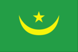
green with a yellow, five-pointed star between the horns of a yellow, upward-pointing crescent moon; red stripes along the top and bottom edges; the crescent, star, and color green are traditional symbols of Islam; green also represents hope for a bright future; the yellow color stands for the sands of the Sahara; red symbolizes the blood shed in the struggle for independence
Government type
presidential republic
Independence
28 November 1960 (from France)
International law organization participation
has not submitted an ICJ jurisdiction declaration; non-party state to the ICCt
International organization participation
ABEDA, ACP, AfDB, AFESD, AMF, AMU, AU, CAEU, EITI (compliant country), FAO, G-77, IAEA, IBRD, ICAO, ICC (NGOs), ICRM, IDA, IDB, IFAD, IFC, IFRCS, IHO (pending member), ILO, IMF, IMO, Interpol, IOC, IOM, IPU, ISO (correspondent), ITSO, ITU, ITUC (NGOs), LAS, MIGA, NAM, OIC, OIF, OPCW, UN, UNCTAD, UNESCO, UNHRC, UNIDO, UNWTO, UPU, WCO, WHO, WIPO, WMO, WTO
Judicial branch
- highest court(s)
- Supreme Court or Cour Supreme (subdivided into 7 chambers: 2 civil, 2 labor, 1 commercial, 1 administrative, and 1 criminal, each with a chamber president and 2 councilors ); Constitutional Council (consists of 9 members); High Court of Justice (consists of 9 members)
- judge selection and term of office
- Supreme Court president appointed by the president of the republic to serve a 5-year renewable term; Constitutional Council members appointed - 3 by the president of the republic, 2 by the president of the National Assembly, 1 by the prime minister, 1 by the leader of the democratic opposition, 1 by the largest opposition party in the National Assembly, and 1 by the second largest party in the National Assembly; members serve single, 9-year terms with one-third of membership renewed every 3 years; High Court of Justice members appointed by Parliament - 6 by the ruling Coalition of Majority Parties and 3 by opposition parties
- subordinate courts
- Courts of Appeal; courts of first instance or wilya courts are established in the regions' headquarters and include commercial and labor courts, criminal courts, Moughataa (district) Courts, and informal/customary courts
Legal system
mixed legal system of Islamic and French civil law
Legislative branch
- description
- unicameral Parliament or Barlamane consists of the National Assembly or Al Jamiya Al Wataniya (176 seats statutory; 88 members filled from one or two seat constituencies elected by a two-round majority system and the other 88 members filled from a single, nationwide constituency directly elected by proportional representation vote); 20 seats are reserved for women candidates in the nationwide constituency, 11 seats are reserved for young candidates (aged between 25 and 35), and 4 members directly elected by the diaspora; all members serve 5-year terms
- election results
- National Assembly - percent of vote by party - NA; seats by party - El INSAF 107, Tawassoul 11, UDP 10, FRUD (Republican Front for Unity and Democracy) 7, El Islah (Reformist Party) 6, National Democratic Alliance (AND) 6, El Karama (Dignity Party) 5, Nida Al-Watan 5, Sawab 5, Alliance for Justice and Democracy/Movement for Renewal 4, Hiwar 3, Mauritanian Party for Union and Change (HATEM) 3, El Vadila (Party of Virtue) 2, Union for Planning and Construction (UPC) 1, Party of the Mauritanian Masses (Hakam) 1; composition - men, 135, women 41, percent of women elected 23.3%
- elections
- last held in 2 rounds on 13 and 27 May 2023 (next to be held in May 2028)
- note
- note - the early parliamentary elections in 2023 were the first to be held under President Mohamed Ould Cheikh El Ghazouani, elected in 2019 in a first peaceful transition of power; the elections followed the agreement between the government and parties in September 2022 to renew the Independent National Electoral Commission (CENI) and hold the elections in the first semester of 2023 for climatic and logistical reasons
National anthem
- lyrics/music
- unknown/traditional, Rageh DAOUD
- name
- "Bilāda l-ʾubāti l-hudāti l-kirām" (Land of the Proud, Guided by Noblemen)
- note
- note: adopted 28 November 2017, preceded by "National Anthem of the Islamic Republic of Mauritania"
National heritage
- selected World Heritage Site locales
- Ancient Ksour (Fortified Villages) of Ouadane, Chinguetti, Tichitt, and Oualata (c); Banc d'Arguin National Park (n)
- total World Heritage Sites
- 2 (1 cultural, 1 natural)
National holiday
Independence Day, 28 November (1960)
National symbol(s)
five-pointed star between the horns of a horizontal crescent moon; national colors: green, yellow
Political parties and leaders
Alliance for Justice and Democracy/Movement for Renewal or AJD/MR [Ibrahima Moctar SARR]El Insaf or Equity Party [Mohamed Melainine Ould EYIH]El Islah Party [Mohamed Ould TALEBNA]El Karama Party [Cheikhna Ould Mohamed Ould HAJBOU]El Vadila [Ethmane Ould Cheikh Ahmed Eboul MEALY]FRUD (Republican Front for Unity and Democracy) [Kadiata Malick DIALLO]Mauritanian Party of Union and Change (HATEM) [Saleh Ould HANENNA]National Democratic Alliance or AND [Yacoub Ould MOINE]National Rally for Reform and Development or RNRD or TAWASSOUL [Hamadi Ould Sidi MOKHTAR]Nida El-Watan [Daoud Ould Ahmed AICHA]Party for Conciliation and Prosperity or HIWAR [Valle Mint Mini]Party of the Mauritanian Masses (Hakam) [El Khalil Ould ENNAHOUI]Sawab Party [Ahmed Salem Ould HORMA]Union for Democracy and Progress or UDP [Naha Mint MOUKNASS]Union of Planning and Construction (UPC) [Qari Ould Mohamed ABDALLAHI]note: only parties with seats in the National Assembly listed
Suffrage
18 years of age; universal
Economy
Agricultural products
rice, milk, goat milk, sheep milk, sorghum, mutton, beef, camel milk, camel meat, dates
Budget
- expenditures
- $1.407 billion (2019 est.)
- revenues
- $1.617 billion (2019 est.)
Budget surplus (+) or deficit (-)
-0.8% (of GDP) (2017 est.)
Current account balance
- Current account balance 2019
- -$831.106 million (2019 est.)
- Current account balance 2020
- -$576.175 million (2020 est.)
- Current account balance 2021
- -$807.862 million (2021 est.)
Debt - external
- Debt - external 31 December 2016
- $3.899 billion (31 December 2016 est.)
- Debt - external 31 December 2017
- $4.15 billion (31 December 2017 est.)
Economic overview
lower middle-income West African economy; primarily agrarian; rising urbanization; poor property rights; systemic corruption; endemic social and workforce tensions; wide-scale terrorism; foreign over-fishing; environmentally fragile
Exchange rates
- Currency
- ouguiyas (MRO) per US dollar -
- Exchange rates 2017
- 35.794 (2017 est.)
- Exchange rates 2018
- 35.678 (2018 est.)
- Exchange rates 2019
- 36.691 (2019 est.)
- Exchange rates 2020
- 37.189 (2020 est.)
- Exchange rates 2021
- 36.063 (2021 est.)
Exports
- Exports 2019
- $2.525 billion (2019 est.)
- Exports 2020
- $2.784 billion (2020 est.) note: data are in current year dollars
- Exports 2021
- $3.18 billion (2021 est.) note: data are in current year dollars
Exports - commodities
iron ore, gold, mollusks and shellfish, frozen fish, copper ore (2021)
Exports - partners
China 32%, Switzerland 13%, Spain 9%, Japan 9%, Italy 5% (2019)
Fiscal year
calendar year
GDP - composition, by end use
- exports of goods and services
- 39% (2017 est.)
- government consumption
- 21.8% (2017 est.)
- household consumption
- 64.9% (2017 est.)
- imports of goods and services
- -78.6% (2017 est.)
- investment in fixed capital
- 56.1% (2017 est.)
- investment in inventories
- -3.2% (2017 est.)
GDP - composition, by sector of origin
- agriculture
- 27.8% (2017 est.)
- industry
- 29.3% (2017 est.)
- services
- 42.9% (2017 est.)
GDP (official exchange rate)
$706 million (2018 est.)
Gini Index coefficient - distribution of family income
- Gini Index coefficient - distribution of family income 2014
- 32.6 (2014 est.)
Household income or consumption by percentage share
- highest 10%
- 29.5% (2000)
- lowest 10%
- 2.5%
Imports
- Imports 2019
- $3.683 billion (2019 est.)
- Imports 2020
- $3.675 billion (2020 est.) note: data are in current year dollars
- Imports 2021
- $4.312 billion (2021 est.) note: data are in current year dollars
Imports - commodities
ships, aircraft, wheat, raw sugar, refined petroleum (2019)
Imports - partners
China 26%, France 6%, Spain 6%, Morocco 6%, United Arab Emirates 5% (2019)
Industrial production growth rate
-6.61% (2021 est.)
Industries
- fish processing, oil production, mining (iron ore, gold, copper)
- note
- note: gypsum deposits have never been exploited
Inflation rate (consumer prices)
- Inflation rate (consumer prices) 2019
- 2.3% (2019 est.)
- Inflation rate (consumer prices) 2020
- 2.39% (2020 est.)
- Inflation rate (consumer prices) 2021
- 3.57% (2021 est.)
Labor force
1.197 million (2021 est.)
Population below poverty line
31% (2014 est.)
Public debt
- Public debt 2016
- 100% of GDP (2016 est.)
- Public debt 2017
- 96.6% of GDP (2017 est.)
Real GDP (purchasing power parity)
- note
- note: data are in 2017 dollars
- Real GDP (purchasing power parity) 2019
- $24.136 billion (2019 est.)
- Real GDP (purchasing power parity) 2020
- $23.909 billion (2020 est.)
- Real GDP (purchasing power parity) 2021
- $24.494 billion (2021 est.)
Real GDP growth rate
- Real GDP growth rate 2019
- 5.3% (2019 est.)
- Real GDP growth rate 2020
- -0.94% (2020 est.)
- Real GDP growth rate 2021
- 2.45% (2021 est.)
Real GDP per capita
- note
- note: data are in 2017 dollars
- Real GDP per capita 2019
- $5,500 (2019 est.)
- Real GDP per capita 2020
- $5,300 (2020 est.)
- Real GDP per capita 2021
- $5,300 (2021 est.)
Reserves of foreign exchange and gold
- Reserves of foreign exchange and gold 31 December 2019
- $1.029 billion (31 December 2019 est.)
- Reserves of foreign exchange and gold 31 December 2020
- $1.493 billion (31 December 2020 est.)
- Reserves of foreign exchange and gold 31 December 2021
- $2.039 billion (31 December 2021 est.)
Taxes and other revenues
27.4% (of GDP) (2017 est.)
Unemployment rate
- Unemployment rate 2019
- 10.39% (2019 est.)
- Unemployment rate 2020
- 11.27% (2020 est.)
- Unemployment rate 2021
- 11.46% (2021 est.)
Youth unemployment rate (ages 15-24)
- female
- 27.9%
- male
- 20.8%
- total
- 23% (2021 est.)
Energy
Carbon dioxide emissions
- from coal and metallurgical coke
- 0 metric tonnes of CO2 (2019 est.)
- from consumed natural gas
- 0 metric tonnes of CO2 (2019 est.)
- from petroleum and other liquids
- 4.041 million metric tonnes of CO2 (2019 est.)
- total emissions
- 4.041 million metric tonnes of CO2 (2019 est.)
Coal
- consumption
- 0 metric tons (2020 est.)
- exports
- 0 metric tons (2020 est.)
- imports
- 0 metric tons (2020 est.)
- production
- 0 metric tons (2020 est.)
- proven reserves
- 0 metric tons (2019 est.)
Electricity
- consumption
- 1.577 billion kWh (2019 est.)
- exports
- 0 kWh (2019 est.)
- imports
- 0 kWh (2019 est.)
- installed generating capacity
- 656,000 kW (2020 est.)
- transmission/distribution losses
- 245 million kWh (2019 est.)
Electricity access
- electrification - rural areas
- 1% (2020)
- electrification - total population
- 47.6% (2021)
- electrification - urban areas
- 89.6% (2021)
- population without electricity
- 3 million (2020)
Electricity generation sources
- biomass and waste
- 0% of total installed capacity (2020 est.)
- fossil fuels
- 73.2% of total installed capacity (2020 est.)
- geothermal
- 0% of total installed capacity (2020 est.)
- hydroelectricity
- 11.9% of total installed capacity (2020 est.)
- nuclear
- 0% of total installed capacity (2020 est.)
- solar
- 8.1% of total installed capacity (2020 est.)
- tide and wave
- 0% of total installed capacity (2020 est.)
- wind
- 6.8% of total installed capacity (2020 est.)
Energy consumption per capita
- Total energy consumption per capita 2019
- 13.558 million Btu/person (2019 est.)
Natural gas
- consumption
- 0 cubic meters (2021 est.)
- exports
- 0 cubic meters (2021 est.)
- imports
- 0 cubic meters (2021 est.)
- production
- 0 cubic meters (2021 est.)
- proven reserves
- 28.317 billion cubic meters (2021 est.)
Petroleum
- crude oil and lease condensate exports
- 4,800 bbl/day (2018 est.)
- crude oil and lease condensate imports
- 0 bbl/day (2018 est.)
- crude oil estimated reserves
- 20 million barrels (2021 est.)
- refined petroleum consumption
- 27,500 bbl/day (2019 est.)
- total petroleum production
- 0 bbl/day (2021 est.)
Refined petroleum products - exports
0 bbl/day (2015 est.)
Refined petroleum products - imports
17,290 bbl/day (2015 est.)
Refined petroleum products - production
0 bbl/day (2015 est.)
Communications
Broadband - fixed subscriptions
- subscriptions per 100 inhabitants
- 0.4 (2020 est.)
- total
- 18,457 (2020 est.)
Broadcast media
12 TV stations: 6 government-owned and 6 private (the 6th was started in early 2022, owed by the President of Mauritanian Businessmen); in October 2017, the government suspended most private TV stations due to non-payment of broadcasting fees, but they later negotiated payment options with the government and are back since 2019. There are 19 radio broadcasters: 15 government-owned, 4 (Radio Nouakchott Libre, Radio Tenwir, Radio Kobeni and Mauritanid) private; all 4 private radio stations broadcast from Nouakchott; of the 15 government stations, 4 broadcast from Nouakchott (Radio Mauritanie, Radio Jeunesse, Radio Koran and Mauritanid) and the other 12 broadcast from each of the 12 regions outside Nouakchott; Radio Jeunesse and Radio Koran are now also being re-broadcast in all the regions. (2022)
Internet country code
.mr
Internet users
- percent of population
- 59% (2021 est.)
- total
- 2.714 million (2021 est.)
Telecommunication systems
- domestic
- fixed-line teledensity 1 per 100 persons; mobile-cellular teledensity of roughly 141 per 100 persons (2021)
- general assessment
- Mauritania’s small population and low economic output has limited the country’s ability to develop sustained growth in the telecom sector; low disposable income has restricted growth in the use of services, and thus of revenue which telcos can hope to gain from subscribers; this has impacted on their ability to invest in network upgrades and improvements to service offerings; this has been reflected in the repeated fines imposed against them by the regulator for failing to ensure a good quality of service; there are also practical challenges relating to transparency and tax burdens which have hindered foreign investment; financial support has been forthcoming from the government as well as the World Bank and European Investment Bank; their efforts have focused on implementing appropriate regulatory measures and promoting the further penetration of fixed-line broadband services by improving the national backbone network, ensuring connectivity to international telecom cables, and facilitating operator access to infrastructure; progress has been made to improve internet bandwidth capacity, including the completion of a cable link at the border with Algeria, and the connection to the EllaLink submarine cable; the final stage of the national backbone network was completed in December 2021, which now runs to some 4,000km; penetration of fixed telephony and broadband service is very low and is expected to remain so in coming years, though growth is anticipated following improvements to backbone infrastructure and the reduction in access pricing; most voice and data services are carried over the mobile networks (2022)
- international
- country code - 222; landing point for the ACE submarine cable for connectivity to 19 West African countries and 2 European countries; satellite earth stations - 3 (1 Intelsat - Atlantic Ocean, 2 Arabsat) (2019)
Telephones - fixed lines
- subscriptions per 100 inhabitants
- 1 (2021 est.)
- total subscriptions
- 58,094 (2021 est.)
Telephones - mobile cellular
- subscriptions per 100 inhabitants
- 141 (2021 est.)
- total subscriptions
- 6,512,361 (2021 est.)
Transportation
Airports
30 (2021)
Airports - with paved runways
- 9
- note
- note: paved runways have a concrete or asphalt surface but not all have facilities for refueling, maintenance, or air traffic control; the length of a runway required for aircraft to safely operate depends on a number of factors including the type of aircraft, the takeoff weight (including passengers, cargo, and fuel), engine types, flap settings, landing speed, elevation of the airport, and average maximum daily air temperature; paved runways can reach a length of 5,000 m (16,000 ft.), but the “typical” length of a commercial airline runway is between 2,500-4,000 m (8,000-13,000 ft.)
Airports - with unpaved runways
- 21
- note
- note: unpaved runways have a surface composition such as grass or packed earth and are most suited to the operation of light aircraft; unpaved runways are usually short, often less than 1,000 m (3,280 ft.) in length; airports with unpaved runways often lack facilities for refueling, maintenance, or air traffic control
Civil aircraft registration country code prefix
5T
Merchant marine
- by type
- general cargo 2, other 9
- total
- 11 (2022)
National air transport system
- annual passenger traffic on registered air carriers
- 454,435 (2018)
- inventory of registered aircraft operated by air carriers
- 6
- number of registered air carriers
- 1 (2020)
Ports and terminals
- major seaport(s)
- Nouadhibou, Nouakchott
Railways
- standard gauge
- 728 km (2014) 1.435-m gauge
- total
- 728 km (2014)
Roadways
- paved
- 3,988 km (2018)
- total
- 12,253 km (2018)
- unpaved
- 8,265 km (2018)
Waterways
1,086 km (2022) (some navigation possible on the Senegal River)
Military and Security
Military - note
founded in 1960, the Mauritanian military is responsible for territorial defense and internal security; it also assists in economic development projects, humanitarian missions, and disaster response; securing the border and countering terrorist groups operating in the Sahel, particularly from Mali, are key operational priorities; since a spate of deadly terrorist attacks on civilian and military targets in the 2005-2011 timeframe, the Mauritanian Government has increased the defense budget (up 40% between 2008 and 2018) and military equipment acquisitions, enhanced military training, heightened security cooperation with its neighbors and the international community, and built up the military’s counterinsurgency and counterterrorism forces and capabilities; equipment acquisitions have prioritized mobility, flexibility, and intelligence collection, including light ground attack and reconnaissance aircraft, assault helicopters, patrol vessels, light trucks, and surveillance radars; Mauritania has received foreign security assistance from France, NATO, and the US in areas such as commando/special forces operations, counterterrorism, and professional military educationthe Army has sought to create lighter, more nimble units capable of operating in the harsh environment of the Sahel; since 2009, for example, it has enhanced existing camel-mounted nomad patrol units and created up to 8 Special Intervention Groups (GSI), 200-man French-trained Army commando/counterterrorism units that are mounted on light vehicles, carry their own supplies, and operate in remote desert border areas for extended periods of time; in addition to the GSI and camel-mounted forces, the Army has multiple motorized infantry battalions, plus individual battalions of tanks, light armored reconnaissance, presidential guards, and airborne/commando forces to supplement garrison units stationed throughout the country in 6 military regions; the Gendarmerie has territorial-based, mobile, and specialized units such rapid reaction forces (Rapid Action Group – Surveillance and Intervention Group or GAR-SI) that conduct counterterrorism missions and work with the regular military services; the Air Force has acquired a few light attack combat aircraft in recent years, but remains small with a total inventory of about 20 patrol, transport, and trainer airplanes and helicopters; in addition to 2 offshore patrol vessels acquired from China in 2016, the Navy has a small force of coastal patrol craft and inshore patrol boats to monitor the country’s 750km-long coastline and Economic Exclusion Zone, plus a unit of marines (Fusiliers Marins); it has conducted joint patrols with the Senegalese Navy along their shared maritime border (2023)
Military and security forces
- Mauritanian Armed Forces (aka Armée Nationale Mauritanienne): National Army, National Navy (Marine Nationale), Mauritania Islamic Air Force; Gendarmerie (Ministry of Defense)Ministry of Interior and Decentralization: National Police, National Guard, General Group for Road Safety (2023)
- note
- note 1: the National Police are responsible for enforcing the law and maintaining order in urban areas, while the paramilitary Gendarmerie is responsible for maintaining civil order around metropolitan areas and providing law enforcement services in rural areas; like the Mauritanian Armed Forces, the Gendarmerie is under the Ministry of Defense, but also supports the ministries of Interior and Justicenote 2: the National Guard performs a limited police function in keeping with its peacetime role of providing security at government facilities, to include prisons; regional authorities may call upon the National Guard to restore civil order during riots and other large-scale disturbances note 3: the General Group for Road Safety maintains security on roads and operates checkpoints throughout the country
Military and security service personnel strengths
approximately 16,000 Mauritanian Armed Forces personnel (15,000 Army; 700 Navy; 300 Air Force); estimated 3,000 Gendarmerie; estimated 2,000 National Guard (2023)
Military deployments
450 (plus about 320 police) Central African Republic (MINUSCA) (2023)
Military equipment inventories and acquisitions
the military's inventory is limited and made up largely of older French and Soviet-era equipment; in recent years, Mauritania has received small amounts of mostly secondhand military equipment from a variety of suppliers, with China as the leading provider (2023)
Military expenditures
- Military Expenditures 2018
- 2.3% of GDP (2018 est.)
- Military Expenditures 2019
- 2.1% of GDP (2019 est.)
- Military Expenditures 2020
- 2.5% of GDP (2020 est.)
- Military Expenditures 2021
- 2.4% of GDP (2021 est.)
- Military Expenditures 2022
- 2.5% of GDP (2022 est.)
Military service age and obligation
18 is the legal minimum age for voluntary military service; has a compulsory two-year military service law, but the law has reportedly never been applied (2022)
Transnational Issues
Disputes - international
Mauritania-Algeria: none identified Mauritania-Mali: there are no border disputes, but the border has not been demarcated; talks on demarcation were reportedly being held in February 2022 Mauritania-Morocco: Mauritanian claims to Western Sahara remain dormant; tensions arose in 2016 when Mauritanian soldiers were deployed to Lagouira, a city in the southernmost part of Morocco, and raised their flag Mauritania-Senegal: none identified
Illicit drugs
NA
Refugees and internally displaced persons
- refugees (country of origin)
- 26,000 (Sahrawis) (2021); 104,080 (Mali) (2023)
Terrorism
Terrorist group(s)
Al-Qa'ida in the Islamic Maghreb (AQIM)
Environment
Air pollutants
- carbon dioxide emissions
- 2.74 megatons (2016 est.)
- methane emissions
- 6.16 megatons (2020 est.)
- particulate matter emissions
- 41.98 micrograms per cubic meter (2019 est.)
Climate
desert; constantly hot, dry, dusty
Environment - current issues
overgrazing, deforestation, and soil erosion aggravated by drought are contributing to desertification; limited natural freshwater resources away from the Senegal, which is the only perennial river; locust infestation
Environment - international agreements
- party to
- Biodiversity, Climate Change, Climate Change-Kyoto Protocol, Climate Change-Paris Agreement, Comprehensive Nuclear Test Ban, Desertification, Endangered Species, Hazardous Wastes, Law of the Sea, Nuclear Test Ban, Ozone Layer Protection, Ship Pollution, Wetlands, Whaling
- signed, but not ratified
- none of the selected agreements
Food insecurity
- widespread lack of access
- due to high food prices - according to the latest analysis, over 472,000 people are projected to be in need of humanitarian assistance during the June to August 2023 lean season; this would be an improvement compared to the previous year, mostly due to a substantial increase in cereal production in 2022; high food prices, in particular of imported wheat, continue to worsen acute food security (2023)
Land use
- agricultural land
- 38.5% (2018 est.)
- agricultural land: arable land
- arable land: 0.4% (2018 est.)
- agricultural land: permanent crops
- permanent crops: 0% (2018 est.)
- agricultural land: permanent pasture
- permanent pasture: 38.1% (2018 est.)
- forest
- 0.2% (2018 est.)
- other
- 61.3% (2018 est.)
Major aquifers
Senegalo-Mauritanian Basin, Taodeni-Tanzerouft Basin
Major rivers (by length in km)
Senegal river mouth (shared with Guinea [s], Senegal and Mali) - 1,641 kmnote – [s] after country name indicates river source; [m] after country name indicates river mouth
Major watersheds (area sq km)
Atlantic Ocean drainage: Niger (2,261,741 sq km), Senegal (456,397 sq km)
Revenue from coal
0% of GDP (2018 est.)
Revenue from forest resources
1.3% of GDP (2018 est.)
Total renewable water resources
11.4 billion cubic meters (2020 est.)
Total water withdrawal
- agricultural
- 1.2 billion cubic meters (2020 est.)
- industrial
- 30 million cubic meters (2020 est.)
- municipal
- 100 million cubic meters (2020 est.)
Urbanization
- rate of urbanization
- 3.84% annual rate of change (2020-25 est.)
- urban population
- 57.7% of total population (2023)
Waste and recycling
- municipal solid waste generated annually
- 454,000 tons (2009 est.)
- municipal solid waste recycled annually
- 36,320 tons (2009 est.)
- percent of municipal solid waste recycled
- 8% (2009 est.)