ancient
108 views
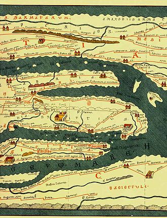
Tabula Peutingeriana
Tabula Peutingeriana, also known as Peutinger's Tabula, Peutinger tables and Peutinger Table, is an illustrated itinerarium showing the layout of the cursus publicus, the road network of the Roman Empire. Ancient Roman road map showing the cursus publicum, the road network of the Roman Empire. It is the only known surviving map from antiquity. The map covers Europe, parts of Asia and Africa.
Tabula Peutingeriana, also known as Peutinger's Tabula, Peutinger tables and Peutinger Table, is an illustrated itinerarium showing the layout of the cursus publicus, the road network of the Roman Empire.
Ancient Roman road map showing the cursus publicum, the road network of the Roman Empire. It is the only known surviving map from antiquity. The map covers Europe, parts of Asia and Africa.
Ancient Roman road map showing the cursus publicum, the road network of the Roman Empire. It is the only known surviving map from antiquity. The map covers Europe, parts of Asia and Africa.
Source: https://en.wikipedia.org/wiki/Tabula_Peutingeriana